What Do You Mean By GPS?
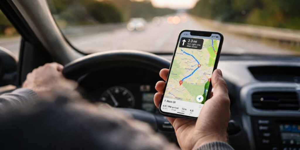
GPS, short for Global Positioning System, is a satellite-based technology that identifies the exact location of a person, vehicle, or device anywhere on Earth. A connected receiver uses satellite signals to deliver real-time positioning data with strong accuracy.
Today, GPS supports everyday tools like smartphones, navigation apps, and fleet trackers. Along with location, it can also provide useful details such as speed, direction, and time.
Across logistics, transportation, and fleet management, GPS helps maintain visibility over vehicles and mobile assets. Reliable location data makes it easier to plan routes, improve driver safety, and manage daily operations.
How Does GPS Work?
GPS works by receiving satellite signals and converting them into exact location data. A connected receiver processes that information within seconds to show where the device is in real time.
Step 1: Satellite signals
GPS satellites orbit the Earth and continuously send signals to receivers below. Every signal includes the satellite’s location and the exact time it was transmitted.
Step 2: Travel time measurement
The receiver measures how long each signal took to arrive. That timing data helps calculate the distance between the device and each satellite.
Step 3: Position calculation
Distance data from multiple satellites allows the receiver to use trilateration. This process identifies the device’s exact position on Earth.
Step 4: Real-time tracking
Fresh signals keep reaching the receiver as the device moves. Continuous calculations help GPS update location, speed, and direction in near real time.
Main Components of the GPS System
GPS operates as a complete system rather than a standalone tool. Accurate positioning depends on three key components working together continuously.
Space Segment
Orbiting satellites form the space segment and transmit signals containing time and location data. These satellites make global positioning possible by covering vast geographic areas.
Control Segment
Ground-based monitoring stations make up the control segment. These stations track satellite performance, manage orbit positions, and maintain clock accuracy to ensure reliable data transmission.
User Segment
Devices that receive and process satellite signals belong to the user segment. Smartphones, in-car navigation systems, wearables, and vehicle trackers all fall into this category.
What Technologies Support GPS Tracking Systems?
Satellite signals provide the foundation of GPS positioning, but modern tracking systems rely on additional technologies for better performance and reliability.
Satellite-Based Positioning
Core location data comes from satellite connections. By linking to multiple satellites, a receiver calculates latitude, longitude, movement, and direction.
Cellular Network Connectivity
Data transmission happens through cellular networks, allowing GPS devices to send location information to apps or software platforms. This enables users and managers to access live tracking remotely.
Wi-Fi Positioning Systems
Urban environments often interfere with satellite signals due to dense infrastructure. Wi-Fi positioning helps improve accuracy in such areas by supplementing GPS data when signals weaken.
Sensors and Telematics Integration
Advanced tracking devices include sensors that capture speed, ignition status, motion, and braking behavior. Combined with GPS data, these inputs provide deeper operational insights beyond basic location tracking.
Cloud-Based Tracking Platforms
Incoming GPS data is stored and processed in cloud platforms, where it is displayed through dashboards, reports, and alerts. These platforms monitor vehicles, analyze routes, and respond to issues from any connected device.
Common Uses of GPS
GPS supports both personal and business needs, which is why it appears in so many devices and industries. Its most common uses include the following:
- Vehicle navigation: GPS powers turn-by-turn directions in smartphones, in-car systems, and route planning apps.
- Fleet tracking: Businesses use GPS to monitor vehicle location, route progress, and dispatch activity in real time.
- Asset tracking: Companies track equipment, trailers, cargo, and other high-value assets to reduce loss and improve control.
- Emergency response: GPS helps emergency teams locate callers, identify routes, and reduce response times.
- Personal safety: Individuals use GPS for vehicle security, family location awareness, and stolen vehicle recovery.
- Logistics monitoring: Shipping and delivery operations rely on GPS to maintain visibility across movements and estimated arrival times.
GPS in Vehicle Tracking and Fleet Management
GPS plays a central role in fleet tracking because it turns vehicle movement into visible, actionable data. Instead of guessing where vehicles are or how routes are progressing, fleet managers can monitor operations as they happen.
Real-time vehicle tracking helps businesses view current locations on a live map. This improves dispatching, delivery coordination, and day-to-day control over fleet activity.
Route monitoring and optimization shows whether drivers are following efficient paths or losing time in traffic and detours. That visibility supports faster decisions and better route planning over time.
Driver behavior monitoring combines GPS with telematics to detect speeding, harsh braking, rapid acceleration, and excessive idling. These insights help businesses improve safety, coaching, and accountability.
Vehicle security and geofencing make it easier to detect unauthorized movement or use outside approved areas. Alerts can be triggered when a vehicle leaves a job site, enters a restricted zone, or moves after work hours.
Operational reporting turns trip data into route history, mileage summaries, utilization trends, and performance reports. As a result, businesses can move from simple tracking to measurable operational improvement.
Why Is GPS Important for Transportation and Logistics?
Transportation and logistics operations depend on timing, coordination, and visibility. Without GPS, it becomes much harder to track vehicles accurately, estimate arrivals, respond to delays, or keep customers informed.
GPS improves logistics by giving businesses live movement data across vehicles, routes, and deliveries. Real-time visibility supports faster dispatching, better communication, and stronger operational control across growing networks.
- Improves delivery accuracy: Businesses can provide more reliable arrival estimates and shipment updates.
- Enables efficient dispatching: Jobs can be assigned to the nearest available vehicle or driver.
- Reduces delays: Managers can react quickly to traffic, road closures, and route disruptions.
- Enhances customer experience: Customers benefit from better communication and greater delivery transparency.
- Improves accountability: Route history and activity records help confirm that vehicles are being used as intended.
Benefits of GPS for Businesses
GPS gives businesses more than basic navigation support. It helps improve visibility, reduce costs, strengthen safety, and support better day-to-day decision-making.
- Real-time operational visibility: Live GPS data shows where vehicles, drivers, or field assets are at any moment. Better visibility makes daily coordination faster and reduces uncertainty across teams.
- Lower fuel and operating costs: Smarter route planning helps reduce idle time, unnecessary mileage, and wasted fuel. Small efficiency gains over time can lead to meaningful cost savings.
- Improved driver safety: GPS data helps businesses identify risky driving patterns and coach drivers with real information. Better monitoring supports safer habits and may also reduce accident-related expenses.
- Stronger theft prevention and recovery: Continuous vehicle and asset monitoring makes it easier to detect unauthorized use. Location alerts and movement history help businesses respond faster when something goes wrong.
- Better data-driven decisions: GPS systems generate useful insights such as route history, mileage trends, utilization records, and performance reports. That data helps improve scheduling, fleet planning, and resource allocation.
Checklist for Choosing a GPS Tracking System
Choosing the right GPS tracking system depends on how well it fits your daily operations and long-term business needs. Instead of focusing on price alone, it is better to evaluate the system based on the features and reliability it offers.
Checklist to consider before selecting a GPS tracking solution:
- Tracking accuracy: The system should provide precise and timely location updates for reliable monitoring.
- Connectivity: It should maintain stable data transmission through cellular or satellite support.
- Ease of use: A simple dashboard and mobile access make tracking and reporting easier to manage.
- Alerts and geofencing: Custom notifications for speeding, idling, or unauthorized movement add more control.
- Driver behavior monitoring: Insights into braking, acceleration, and idle time help improve safety and efficiency.
- Power source and installation: Choose a battery-powered or hardwired device based on your tracking needs.
- Reporting features: Route history, mileage, and usage reports help support better business decisions.
- System integration: Compatibility with telematics, dispatch, or other software improves workflow efficiency.
- Pricing and support: The solution should offer fair pricing along with dependable customer service.
How GPS Tracking Solutions Improve Fleet Efficiency
Many fleet-related problems come from limited visibility rather than lack of effort. When managers cannot see where vehicles are, how routes are progressing, or what drivers are doing, delays and inefficiencies become harder to control.
GPS tracking solutions improve fleet efficiency by turning location and vehicle activity into usable operational insight. With one system, businesses can monitor routes, manage exceptions, reduce wasted time, and respond to problems before they escalate.
A well-designed tracking platform can support live vehicle visibility, trip history, geofence alerts, driver behavior reporting, and route analysis in one place. That combination helps businesses simplify monitoring, improve consistency, and build a more efficient fleet operation over time.
Final Thoughts
GPS has become one of the most important technologies for navigation, tracking, and operational visibility. From everyday route guidance to large-scale fleet management, it helps people and businesses make faster, more informed decisions.
As transportation and logistics become more data-driven, GPS will remain central to accuracy, efficiency, and real-time control. A strong understanding of how it works also makes it easier to choose the right tracking solution for long-term use.
